- Published on
OBIA for Estimating Building Density in Refugee Camp
INTRODUCTION
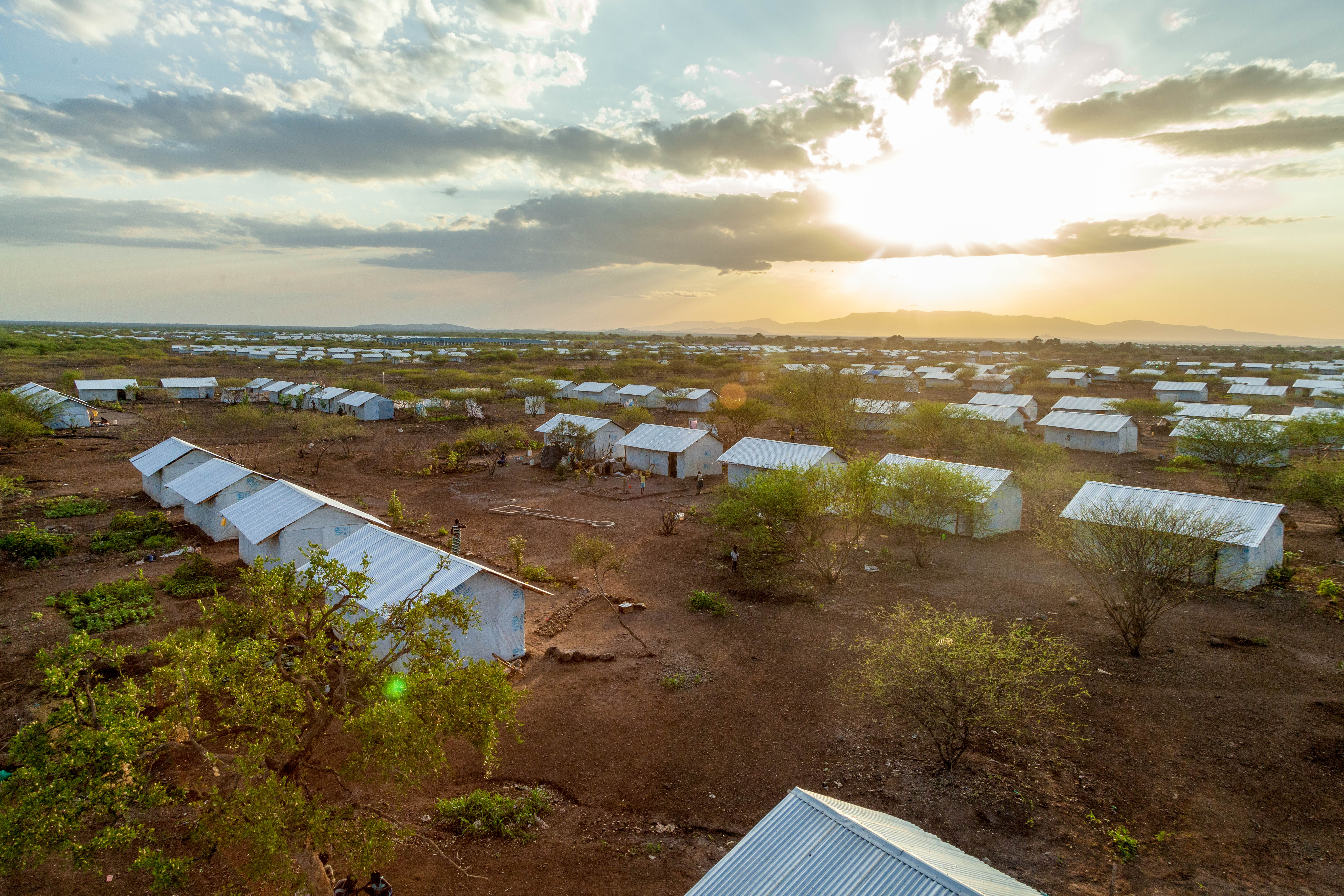
Photo Source: UNHCR
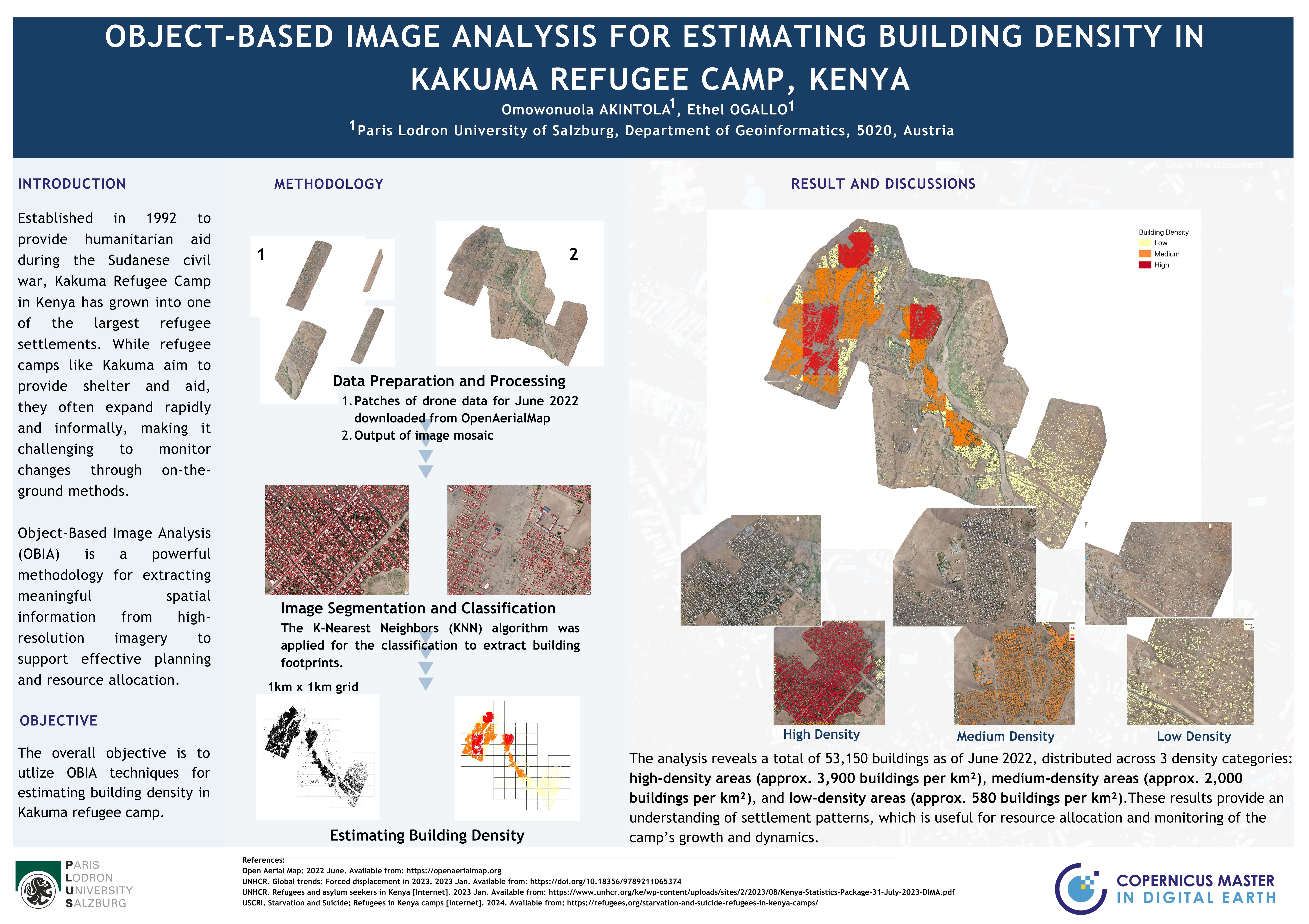
Established in 1992 to provide humanitarian aid during the Sudanese civil war, Kakuma Refugee Camp in Kenya has grown into one of the largest refugee settlements, hosting over 176,000 people from South Sudan, Somalia, and other nations in Sub-Saharan Africa, according to a 2023 UNHCR report. While refugee camps like Kakuma aim to provide shelter and aid, they often expand rapidly and informally, making it challenging to monitor changes through on-the-ground methods.
Object-Based Image Analysis (OBIA) is a powerful methodology for extracting meaningful spatial information from high-resolution imagery to support effective planning and resource allocation.
Methodology
Data collection and Processing -High-resolution drone imagery from June 2022 was downloaded from OpenAerialMap. OpenAerialMap is an open platform for free drone imagery.
- The individual image swath was mosaic'd
Image Segmentation and Classification
- The image was segmented and training samples collected; building and non-building.
- K Nearest Neighbor (KNN) algorithm was applied for the classification to extract features from the imagery. Non-building features were discarded.
Estimating Building Density
- Buildings were categorized based on distribution using a 1km by 1km grid.
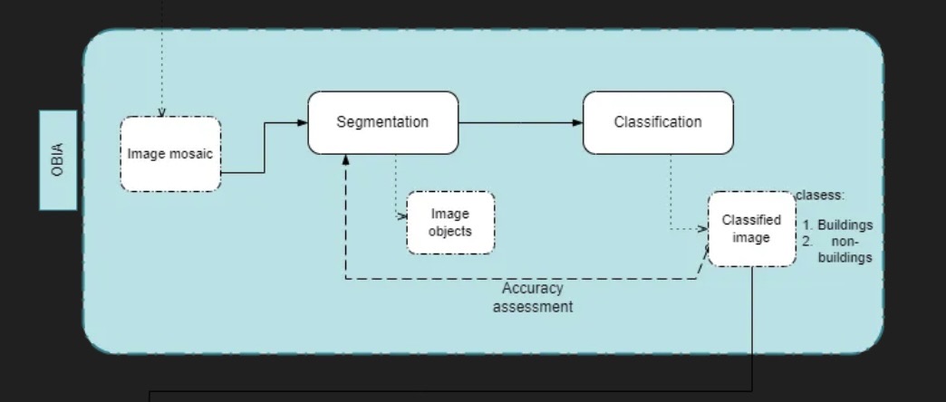
Result
The buildings were mapped into high-density, medium-density, and low-density zones.
Presentation
The project was presented in a scientific poster format.
CONCLUSION
This approach provides a scalable, efficient alternative to building extraction, enabling more effective planning and humanitarian support in refugee settings.
My Master’s program is in Earth Observation and AI (AI4EO) as part of the Copernicus Masters in Digital Earth.