- Published on
A14EO Symposium 2025, Rennes, France
INTRODUCTION
The AI4EO symposium conference was held in Rennes, France from 11- 12 September, 2025. It focused on integrating Artificial Intelligence (AI) techniques into Earth Observation (EO), with themes including remote sensing, foundation models, environmental monitoring, and climate change. The event was organized by OBELIX team of IRISA and aimed to bring together researchers, domain experts, and technologists to share advances and challenges in applying AI to Earth Observation. The event presented a great opportunity to learn about state-of-the-art AI methods in EO data processing, discussing challenges like interpretability and exploring applications for climate monitoring, disaster prediction, land cover mapping, etc.
Keynote Highlights
Responsible AI for Earth Observation — Caroline Gevaert
Caroline Gevaert’s keynote was one of the most thought-provoking sessions for me. She emphasized the importance of responsible AI when applying machine learning to Earth observation, especially in contexts where decisions can impact vulnerable communities. Some of the points that stood out were:
- Human in the loop: AI should not replace decision-makers but guide them. For example, a model might highlight areas that look damaged rather than claiming definitively which houses are destroyed. This helps build trust with users on the ground.
- Bias in ML: It is mathematically impossible to remove all bias. Instead, the focus should be on defining the user group and understanding the specific type of bias that matters in that context. She gave the example of how features in Africa are sometimes poorly represented in training data.
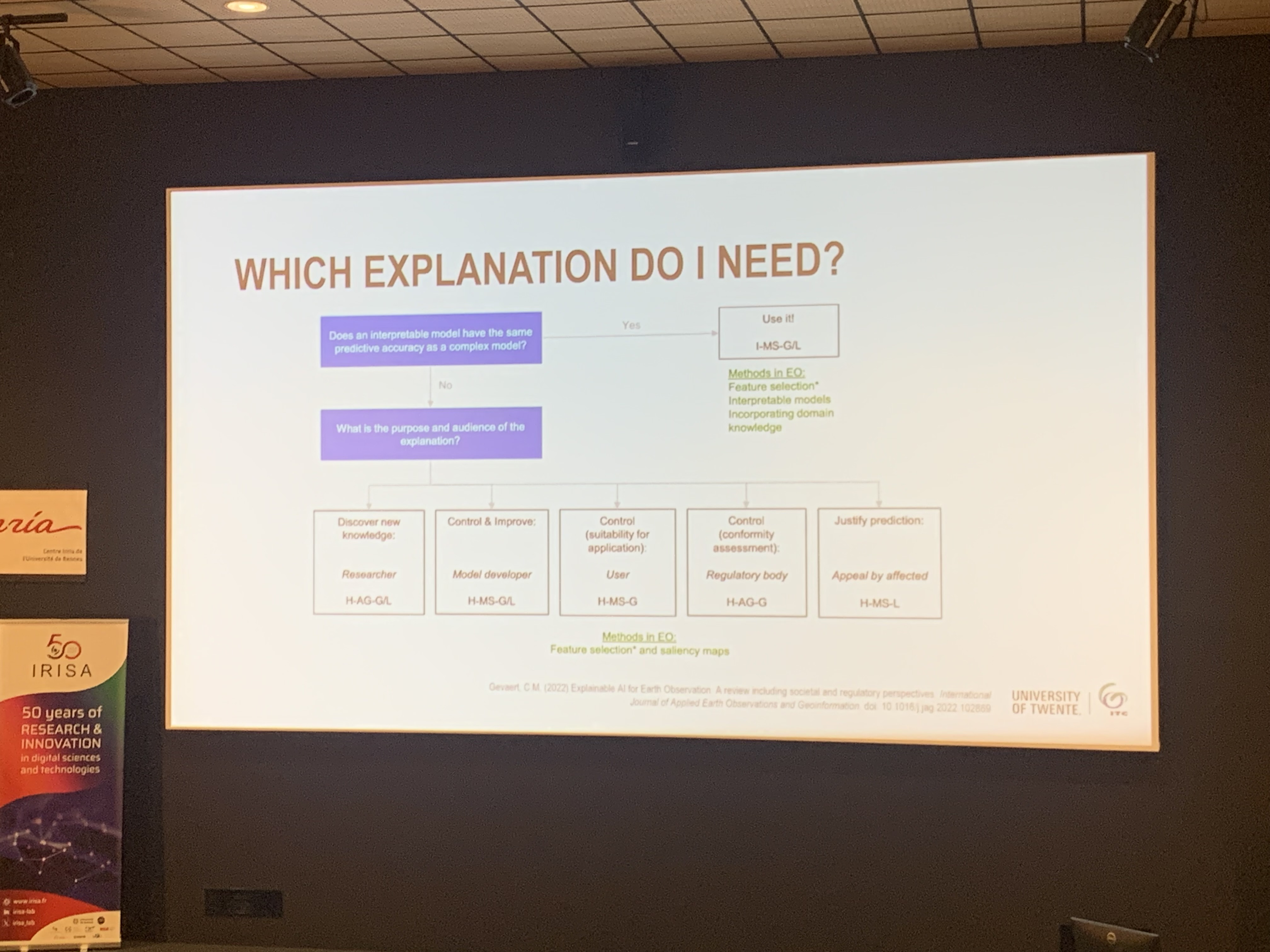
- Explainable AI exits: Mechanisms to “open up” the model are needed so users can control it and understand how and why it makes predictions.
- Audience-specific explanations: Explanations should not be one-size-fits-all but must be tailored to the domain and the expertise of the people using the system.
Machine Learning for Large-Scale Ecosystem Monitoring — Christian Igel
- Showed how scalable ML can process massive EO streams to monitor ecosystems and biodiversity at continental scales.
Large Foundation Models and Their Adaptation to Remote Sensing — Maria Vakalopoulou
- She traced the last decade’s shift from CNN-centric models to Transformer architectures for EO.
- Named architectures mentioned in the talk (from my notes): Anysat, GeoPlex, Aurora, AlphaEarth.
- Remote sensing has unique sensors, resolutions, and viewing geometries; foundation models must be adapted carefully rather than copied from generic vision.
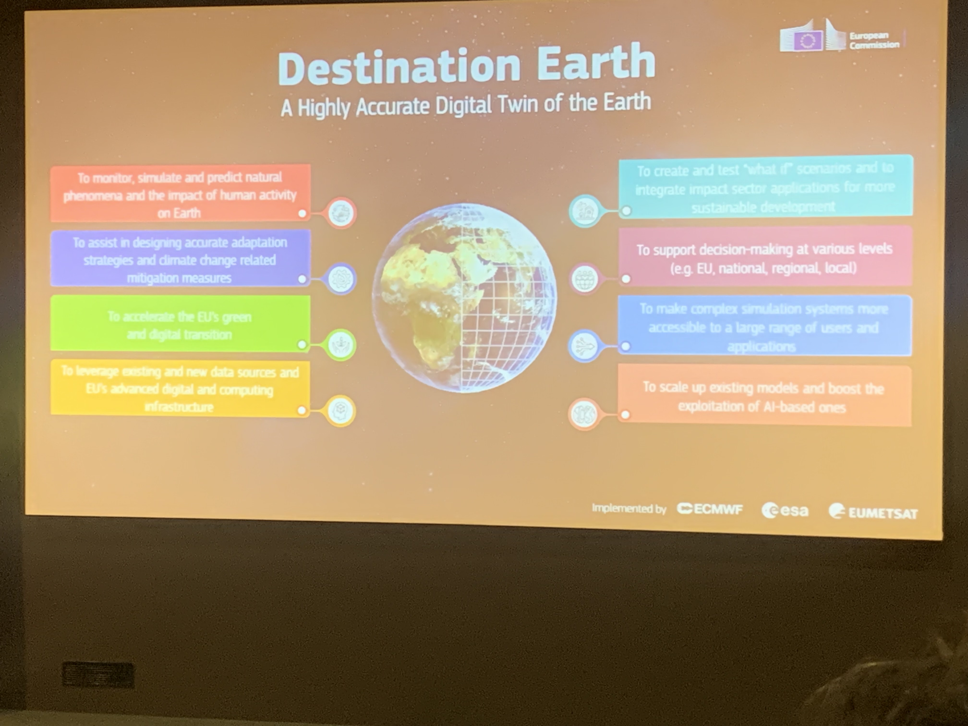
Destination Earth: Building a Digital Replica of the Earth System — Bertrand Le Saux
- Destination Earth” initiative, which aims to build a digital twin of the planet. This system would integrate multiple EO data streams and AI to support climate simulations and environmental monitoring. The ambition is to create a tool that policymakers and scientists can use to anticipate and respond to global challenges.
Poster Sessions I Found Interesting
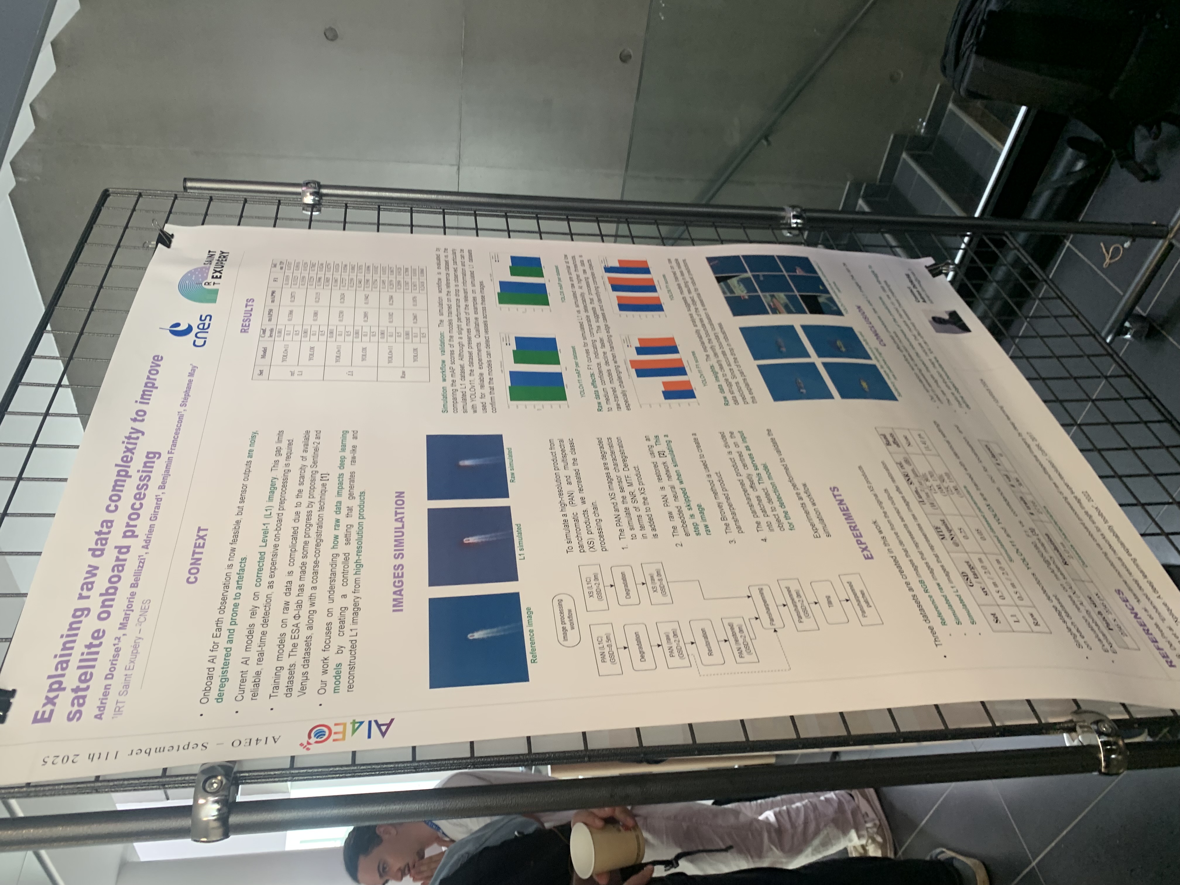
Explaining Raw Data Complexity to Improve Satellite Onboard Processing
This research was produced to test whether meaningful inference can be done directly onboard the satellite, with the aim of generating L1 data without relying on full downlink and extensive ground processing. To do this, the researchers simulated raw sensor imagery, including noise and compression, and trained an AI model on this simulated raw data so it could better reflect on-orbit conditions. I found this interesting because it shows how AI might reduce reliance on heavy ground infrastructure by enabling satellites to deliver usable products directly from orbit.
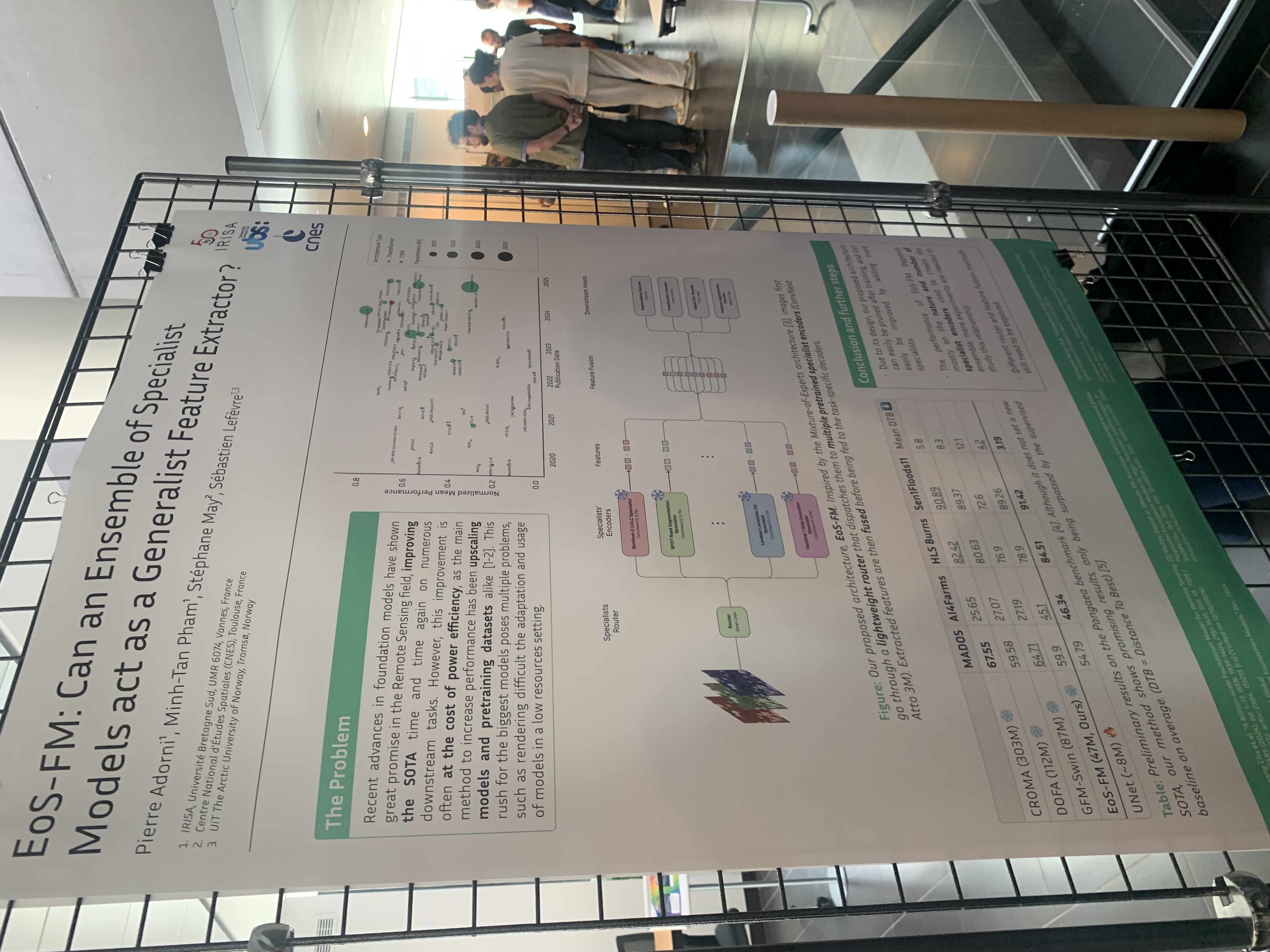
EOS-FM: Can an Ensemble of Specialists Act as a Generalist Feature Extractor?
This work investigated whether combining multiple specialized models into an ensemble foundation model can improve transfer learning across EO tasks. The ensemble included models trained for Sentinel-2 land-use/land-cover classification, road segmentation, Landsat landslide detection, and Sentinel-1 ship detection. The results suggested ensembles can act as generalist extractors, sometimes outperforming a single large model. I found this interesting because it suggests a practical path toward re-using specialized expertise across sensors and tasks
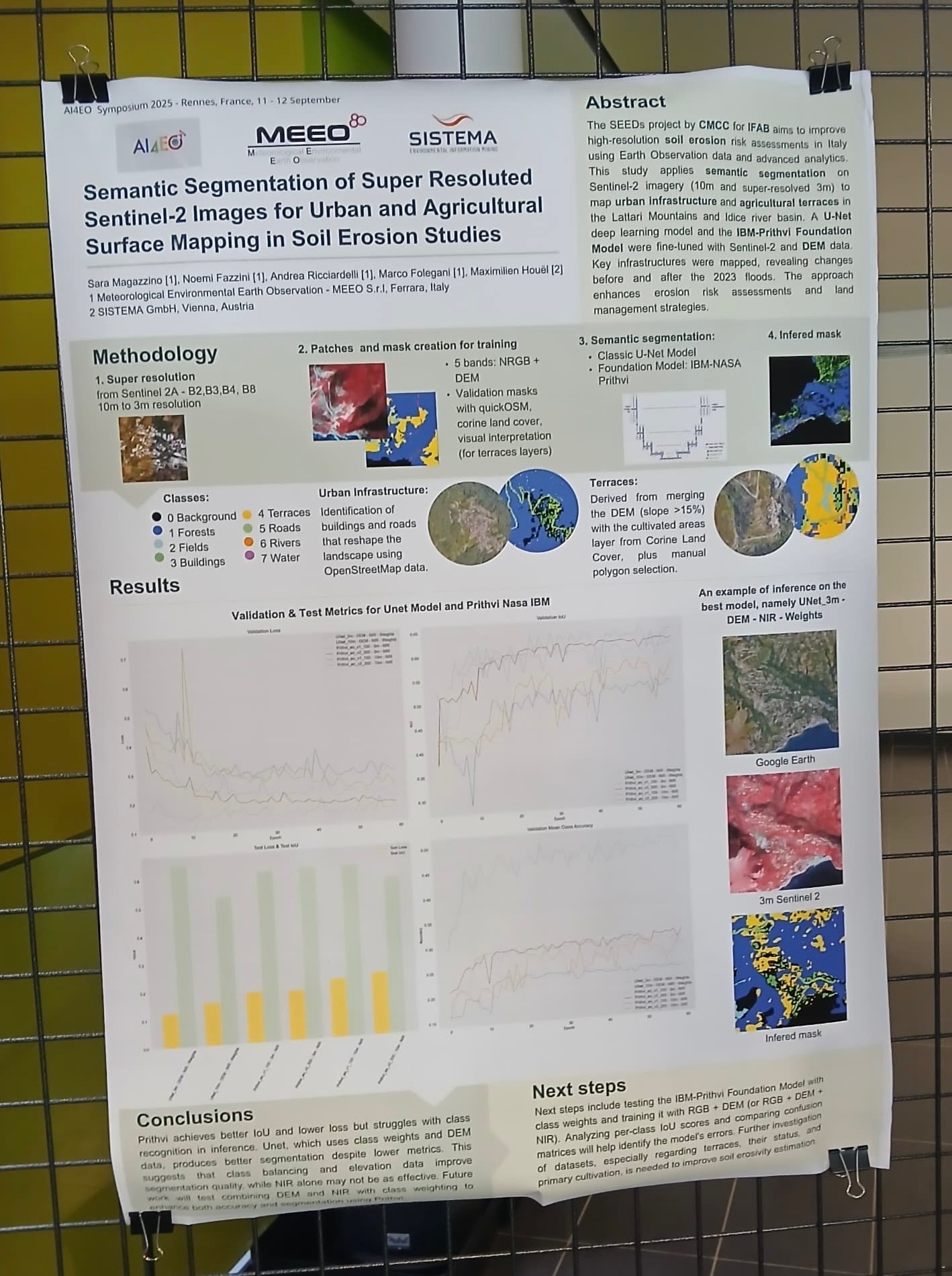
Semantic Segmentation of Super-Resolved Sentinel-2 Images for Soil Erosion Studies
The research addresses a critical challenge within the broader "Soil Erosion Evaluation through Data-driven Solutions" (SEED) project: accurately identifying and mapping different surface types in areas prone to soil erosion using satellite imagery. The SEED project recognizes that current soil erosion quantification tools are inadequate for addressing the complexity of this global environmental problem. Traditional methods lack the spatial detail and temporal resolution needed to assess the landscape features that drive soil-erosion risk. The core technical goal is to develop a high-resolution assessment of soil risk erosion by combining Earth Observation data to classify key surface types including different agricultural lands and urban surfaces. This classification is essential because these surfaces differ in their susceptibility to erosion and in how they shape erosion patterns, and they change over time in ways many tools fail to capture.
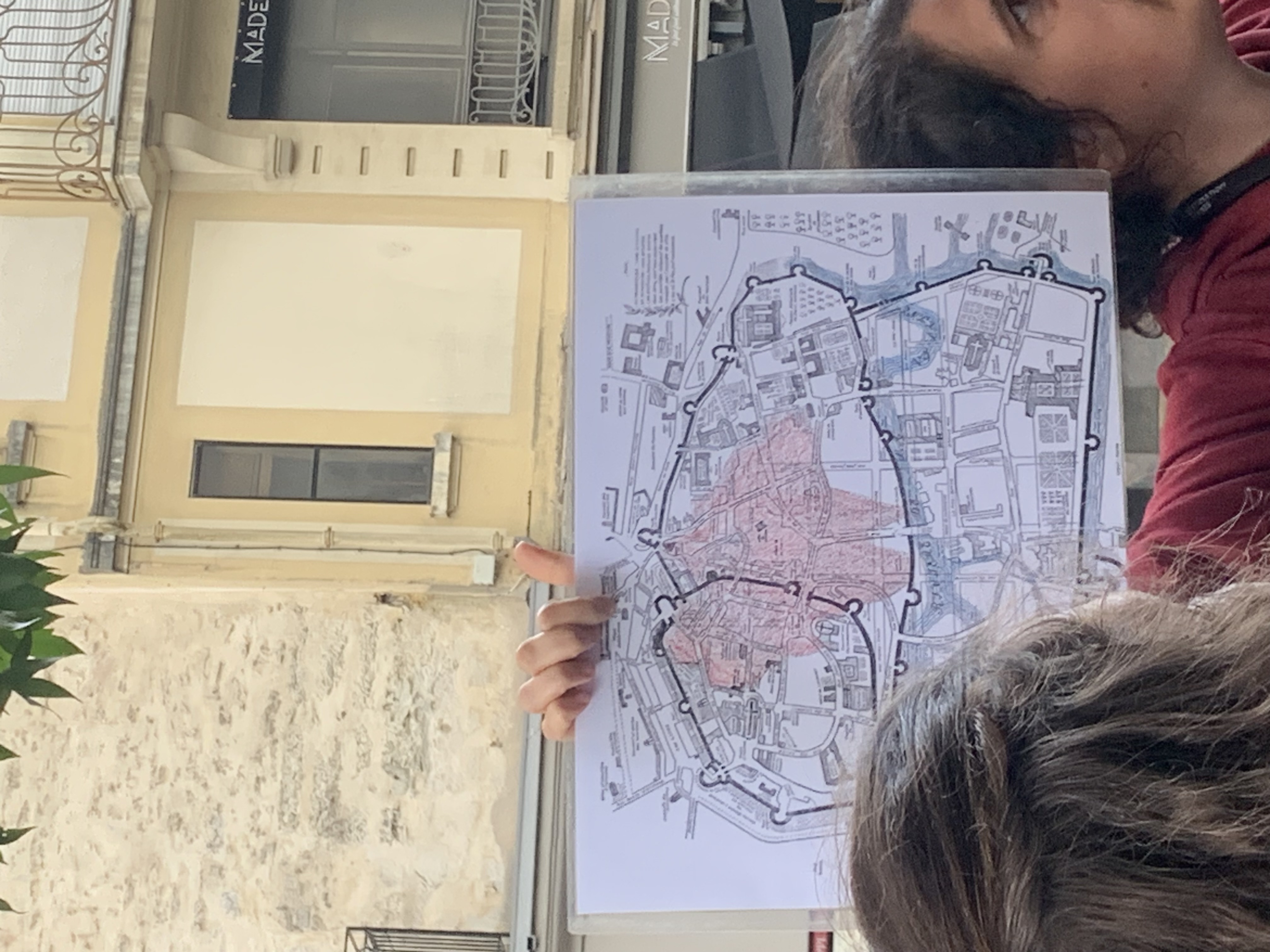
City Tour
Besides the technical sessions, the conference also included a city tour around Rennes. This gave us a chance to learn about the city’s rich culture and history. We visited historic areas and landmarks and ended the night with a wonderful dinner.
Conclusion
As someone new to the field of AI for Earth Observation, I left the conference with a clearer picture of how the field is evolving and a strong appreciation for the amount of great scientific work being done. It showed me both the technical advances and the responsibility needed to make AI truly useful for society.
My Master’s program is in Earth Observation and AI (AI4EO) as part of the Copernicus Masters in Digital Earth.